Hafiz Saeed, Masood Azhar, Dawood Ibrahim Where will They Hide : Cartosat-3 A Force Multiplier To India’s Military Capabilities

Imagine while going to address a Rally somewhere in Pakistan, the speech to be read by Hafeez Saeed, unbeknown to him, a camera on a satellite orbiting more than 500 kilometers above the earth, clicks images of precisely what he is carrying in his hands.
Earlier this month, the Indian Space Research Organisation’s (Isro’s) Cartosat-3 satellite, proved it can do this —revealing a glimpse of what India’s “eyes in the sky” could “see” and, in the process, unlocking an array of strategic possibilities for Indian policymakers.
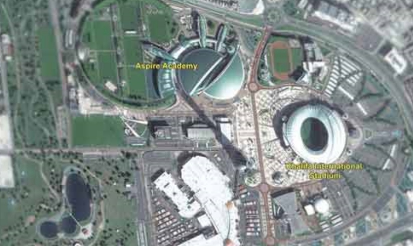
As evidence, Isro released images of some sites in Qatar, captured by the panchromatic (PAN) cameras of Cartosat-3, launched into space in November 2019. The images of Khalifa International Stadium, the Aspire Academy, and Old Doha International Airport, clearly showed various features of the structures captured in those images.
Analysts said the pictures issued by Isro demonstrate only a fraction of what the PAN cameras can actually capture. “What Isro has publicly released is a low resolution image. Yet they are well defined and there is no haziness. The images leave to imagination what would be the quality of the highest resolution images possible by the same Cartosat camera,” said Chaitanya Giri, fellow for space and ocean studies programme at Mumbai-based Gateway House think tank.
Cartosat-3 has on board PAN cameras with a ground resolution of 25cm, the highest-ever achieved by India. This means that the sensors of the camera can detect a feature of that size (25cm) from an altitude of 506km in which Cartosat-3 orbits.
“Today, India has major security concerns related to cross-border terrorism and several topography and terrain related problems along the western border. Such high-resolution imagery is of great strategic significance, particularly over the region where India shares land and water borders with adversaries,” said Ajey Lele, senior fellow at New Delhi-based Institute for Defence Studies and Analyses.
It’s known that such high resolution imagery is not shared publicly and largely restricted for government and military use, but it is indicative of Isro’s growing capabilities. “It matches the current global standards. With this, Isro has shown the world that this is what its satellite capabilities are,” said Lele.
In time, such images could be used by the Indian military to pinpoint locations to carry out precision strikes using a drone. The count down has begun.


