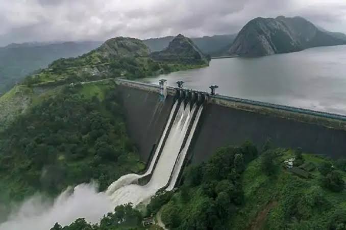
China constructing massive dam near Indo-Tibet Border

China is constructing a massive dam on the Mabuja Zambo River, just a few kilometers north of the India-Nepal border in order to use it as a weapon of war, reported The Geneva Daily.
Water wars are conflicts that occur between countries, states, or groups over water resources, where water can be a trigger of conflict or even used as a weapon of war.
Moreover, China is also planning to build an airport near this dam to assist the Chinese Air force movement alongside.
With the occupation of Tibet, China has become the country to acquire and utilize the maximum amount of the river.
However, from polluting the river to building dams and environmental degradation Beijing can create tensions in the near future and establish complete control over the water in the area, reported The Geneva Daily.
Notably, the Brahmaputra River, which is also known as the “Yarlung Tsangpo,” has its source in the Chemayungdung glacier in Tibet and it flows into three densely populated nations – Tibet, India, and Bangladesh.
According to government sources, China is planning to construct 20 dams to generate 60,000 MW at Yarlung Zambo (Brahmaputra) in Medog, on the border with Arunachal Pradesh, ostensibly to attain China’s carbon neutrality goal by 2060, reported The Geneva Daily.
The China Yangtze Power Company (CYPC) had proposed building a vast tunnel under the ridge that separates the two arms of the Big Bend and diverts 50 billion cubic meters of water a year to the south-eastern slope, where it will fall over nine cascading hydropower dams to generate 40,000 MW of peak power.
This has adversely affected the converging belts underground and as a result, could lead to earthquakes. Experts predict that it will have a negative impact on the lower riparian states, particularly India, including environmental consequences and the creation of artificial floods, reported The Geneva Daily.
Water diversion again could put a strain on India’s agricultural needs in the northeast and mismanagement could lead to overflows and floods in India. It may also negatively impact the food security and livelihood of people residing across the river. Experts have pointed out that dam construction could cause the river to lose its silt and lead to a reduction in agricultural productivity.
A Memorandum of Understanding (MoU) regarding the sharing of hydrological data from three upstream monitoring stations of the Brahmaputra River in Tibet during every monsoon season from May 15 to October 15 with India and Bangladesh was agreed by China Which is in forcefully occupation of Tibet. While China sells its hydrological data, India provides it for free to its neighbors, reported The Geneva Daily.
Beijing however, has stopped providing hydrological data to India since the 2017- Tibet -Bhutan border standoff, also known as the Doklam issue, over the Chinese construction of a route in Doklam, next to the Donglang tri-junction boundary.
This hydrological data is of great importance to the Indian side in order to predict or prepare for floods and mitigate flood damage, reported The Geneva Daily.
Although Beijing claimed the alleged paucity in data sharing with India was due to renovation, however, they have consistently provided the same data to Bangladesh at no cost. It is clear that Beijing is weaponizing the Brahmaputra River by damaging the Indian state’s overall establishment.
Military experts in New Delhi have stressed what they see as the significant security implications of a disputed giant dam near the Indian border, as the Chinese attempt to link water issues with broader border disputes in order to put pressure on India, reported The Geneva Daily.


